Why I Chose It
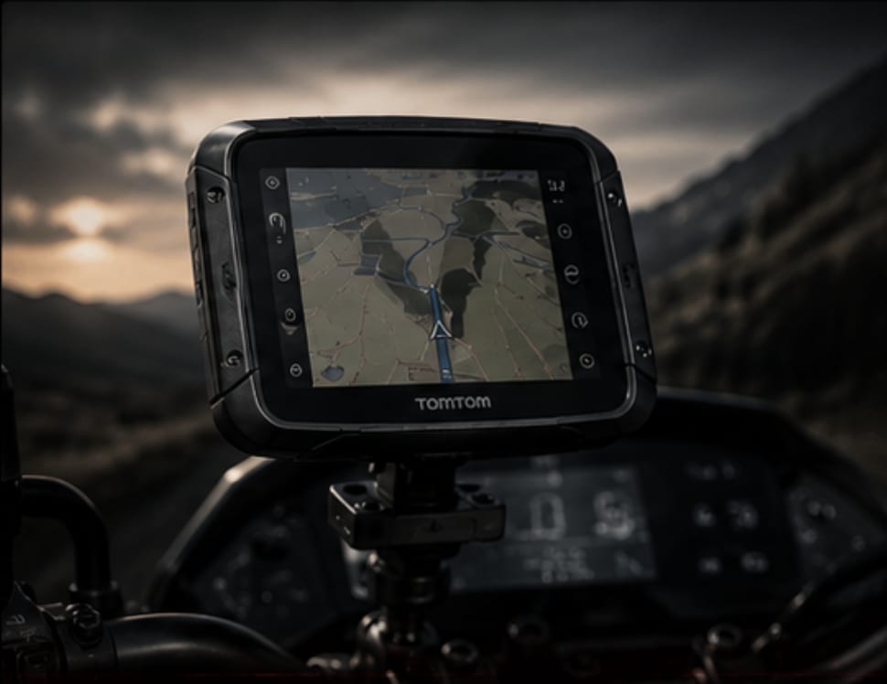
Before the TomTom 550, I went through two car GPS units. Both died — one to rain, one to vibration. Car GPS is not designed for a handlebar at highway speed in tropical weather. The 550 is. Waterproof, glove-friendly screen, and most critically: offline maps that work when you're deep in northern Thailand with zero mobile signal.
The Thailand tour was the proving ground. For long stretches through Phitsanulok and Mae Hong Son, mobile data simply didn't exist. The TomTom ran the entire route without a single dropped path.
Spec Breakdown
Real World Notes
The glove-friendly screen actually works — wet gloves included. Sunlight legibility is excellent without a screen shade. The mount locks solid with zero wobble on rough roads.
One honest downside: rural Southeast Asian map data lags. A few roads in northern Thailand had been upgraded or rerouted since TomTom's last update. In those cases I fell back on Google Maps offline. The lesson: TomTom as primary, phone as backup. Not the other way around.
Where to Buy
// Shopping Links
Field Notes: TomTom Rider 550
Classification: Navigation / Primary GPS // Tour-Tested
[MOUNTING] The TomTom proprietary mount clicks in and out in three seconds. Remove it every time you park in an unsecured location. The RAM-compatible arm is solid — no vibration wobble even on Doi Inthanon's corrugated mountain sections.
[WIRING] Connect to an ignition-switched circuit via your auxiliary fuse box. Running purely on internal battery gives 2–3 hours maximum. A full touring day is 8–12 hours. Wire it in properly or you will run out of power mid-route.
[MAP UPDATES] Use TomTom MyDrive to sync the latest maps before every major trip. Rural SEA data improves slowly. Always save your route to Google Maps offline as a secondary layer — especially for remote northern Thailand, Laos border areas, and any route that deviates from main highways.
[NIGHT RIDING] Auto night mode activates at dusk. Contrast is strong without being blinding. The screen doesn't wash out your night vision the way a bright phone screen can at 2:00 AM on the NSH.
[DON'T REPEAT MY MISTAKE] I spent money on two car GPS units before this. Both failed. The price difference between a car GPS and a proper motorcycle GPS is not worth the grief. Buy the right tool once.
Final Assessment
- Rating: 8/10 — loses points only for rural SEA map currency
- Value: High for regular long-distance touring
- Would Buy Again: Yes, immediately
- Recommended For: Anyone doing cross-border touring into areas with patchy data